
↳ Antarctic
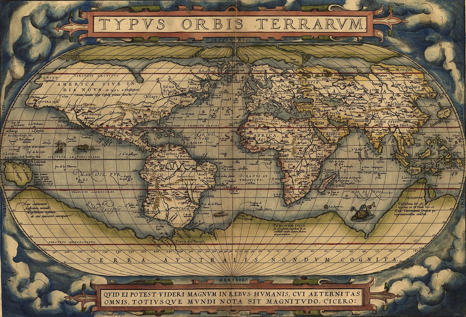
"Typus Orbis Terrarum," a map by Abraham Ortelius, showed the imagined link between the proposed continent of Antarctica and South America. [1564]
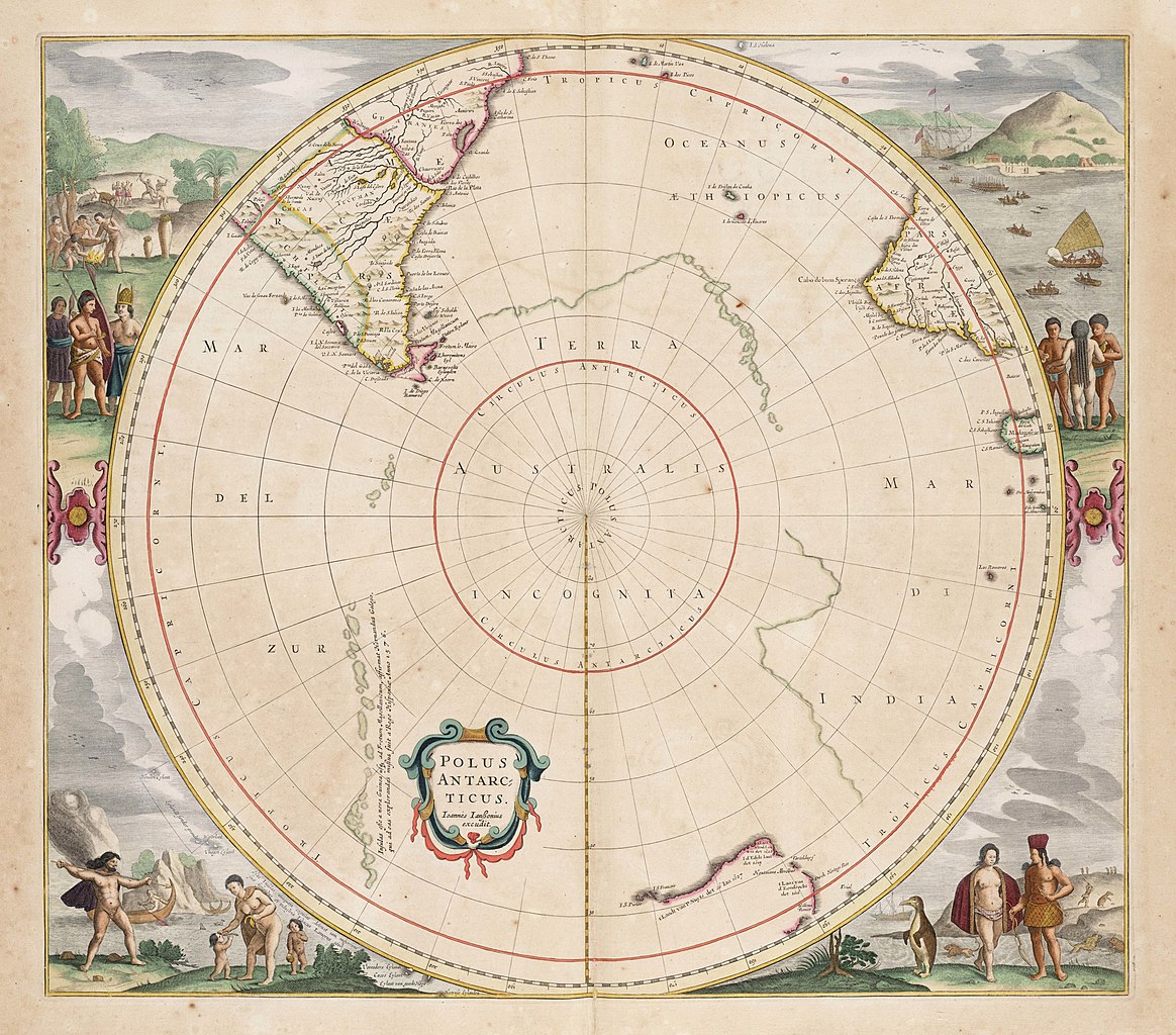
A speculative representation of Antarctica labelled as "Terra Australis Incognita" on Jan Janssonius's "Zeekaart van het Zuidpoolgebied [translation from Dutch: Sea chart of the Antarctic region]." [1657]
Aethiopian, Æthiopian, Æthiopic or Ethiopian Sea or Ocean was the name given to the southern half of the Atlantic Ocean in classical geographical works. The name appeared in maps from ancient times up to the turn of the 19th century. Often, but not always, divided by the equator. [1700s]
↳ Europe
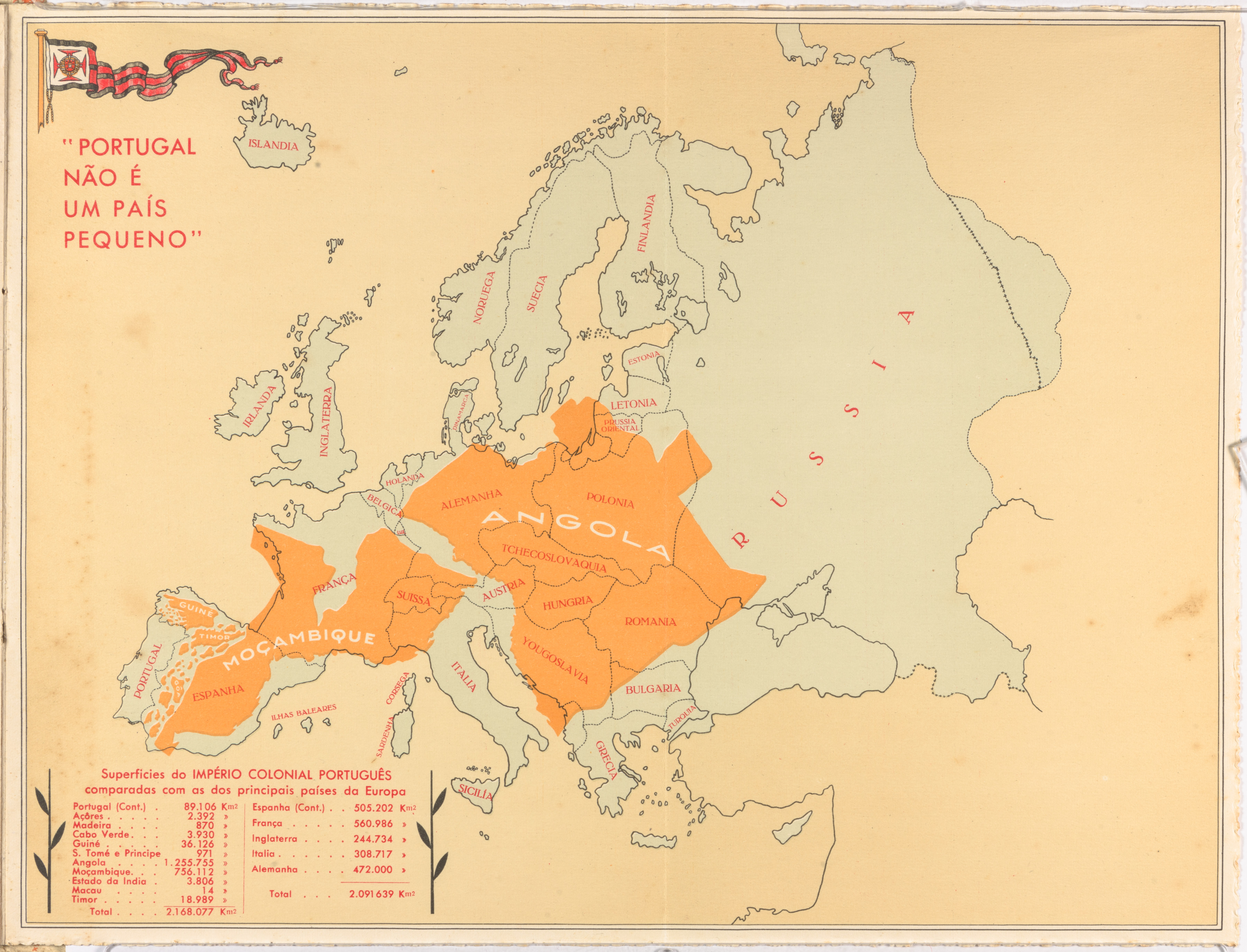
"Portugal Is Not a Small Country"
Antonio Salazar became the Prime Minister of Portugal's military dictatorship in 1932. He founded the authoritarian “Estado Novo” in 1933 and presided as Portugal’s strongman until 1974.
Salazar was intensely focused on promoting the greatness of Portugal and the significance of its Empire, at home and abroad. Maps were a significant part of this effort, and the output of the Salazar regime “demonstrated how cartography can be used as a propaganda weapon in the nationalist and colonialist discourse.”
One of its first initiatives was the First Colonial Portuguese Exhibition (I Exposição Colonial Portuguesa), held in Porto in 1934. A brochure entitled No rumo do império (The Course of Empire) was published to illustrate the Exhibition, and this map was the heart of the brochure. The Exhibition was directed, and the map was produced, by Henrique Galvao, an army officer "very active in the colonial administration and colonial propaganda."
The map shows the colonies of Portugal overlaid on a map of non-Portugese Europe and is entitled “Portugal is not a small country” (Portugal não é um pais pequeno). In the unlikely case that the image alone were insufficient, data on the map shows that Portugal with its colonies (principally Angola and Mozambique) was larger than the total area of Spain, France, England, Italy and Germany combined.
This map was produced not only in the Exhibition brochure, but in a number of other forms and formats over the years. Versions were published not only in Portuguese (aimed at strengthening internal support for the state) but also in other languages (aimed at visitors to Portugal). [source]